
Walk an Arlington Heights Street
An address search can establish far more than a loose name match. Cook County records can identify a parcel, show the assessed property, and connect that PIN to recorded deeds, liens, plats, or easements. A PIN is Cook County's parcel identification number. It is the stable key that joins systems even when an address is spelled in two ways. Ownership is not the same as occupancy, however. A deed names parties to a land record, while a directory or voter response has its own date and purpose.
For the cleanest Arlington Heights street directory trail, save the exact address as printed and note the date of each source. Keep direction, unit, ZIP, and street suffix. Then work through the sources in order:
- Run the address through the Cook County Assessor or Property Tax Portal. Save the PIN, property location, township, and description.
- Carry the PIN into CookViewer. Confirm the selected shape and inspect nearby parcels instead of trusting a map pin alone.
- Search Clerk Recordings by PIN. Preserve the exact document type, number, parties, and recording date.
- Check Arlington Heights permit records in Civic Access. Use Village FOIA when an older file is not exposed online.
- For a past household, use the Memorial Library's dated criss-cross, phone, and municipal directory holdings.
A voter registration lookup is an exact-match tool, not a public street list. Illinois requires a known person's name, birth date, ZIP, and later address controls. It can confirm supplied facts, but it cannot be browsed house by house.
Search Arlington Heights Property Fields
The Cook County Assessor address search accepts a street address or a direct PIN. Its property card can show classification, land area, neighborhood, tax code, reassessment data, building traits, exemptions, appeals, and values. The office warns that property location is not necessarily a legal or postal mailing address. Do not turn it into an occupant claim.
| Search route | Fields to enter | Useful return |
|---|---|---|
| Address | House number, direction, unit, street without suffix, city, CAPTCHA | Candidate parcel and PIN |
| PIN | Direct 14-digit parcel number | Property card |
| Neighborhood | Township, neighborhood, class, CAPTCHA | Comparable parcel set |
| Advanced | Partial PIN, address range, township, year, class | Range or appeal-oriented results |
The separate Cook County Property Tax Portal adds a ZIP field and returns integrated tax, Treasurer, Clerk recording, assessment, and appeal information. It is a strong bridge when the same Arlington Heights address must move between tax and document systems.
The Assessor's property-detail screen shows the fields a street search can reveal. The official property details explanation supplies the source for this captured interface.
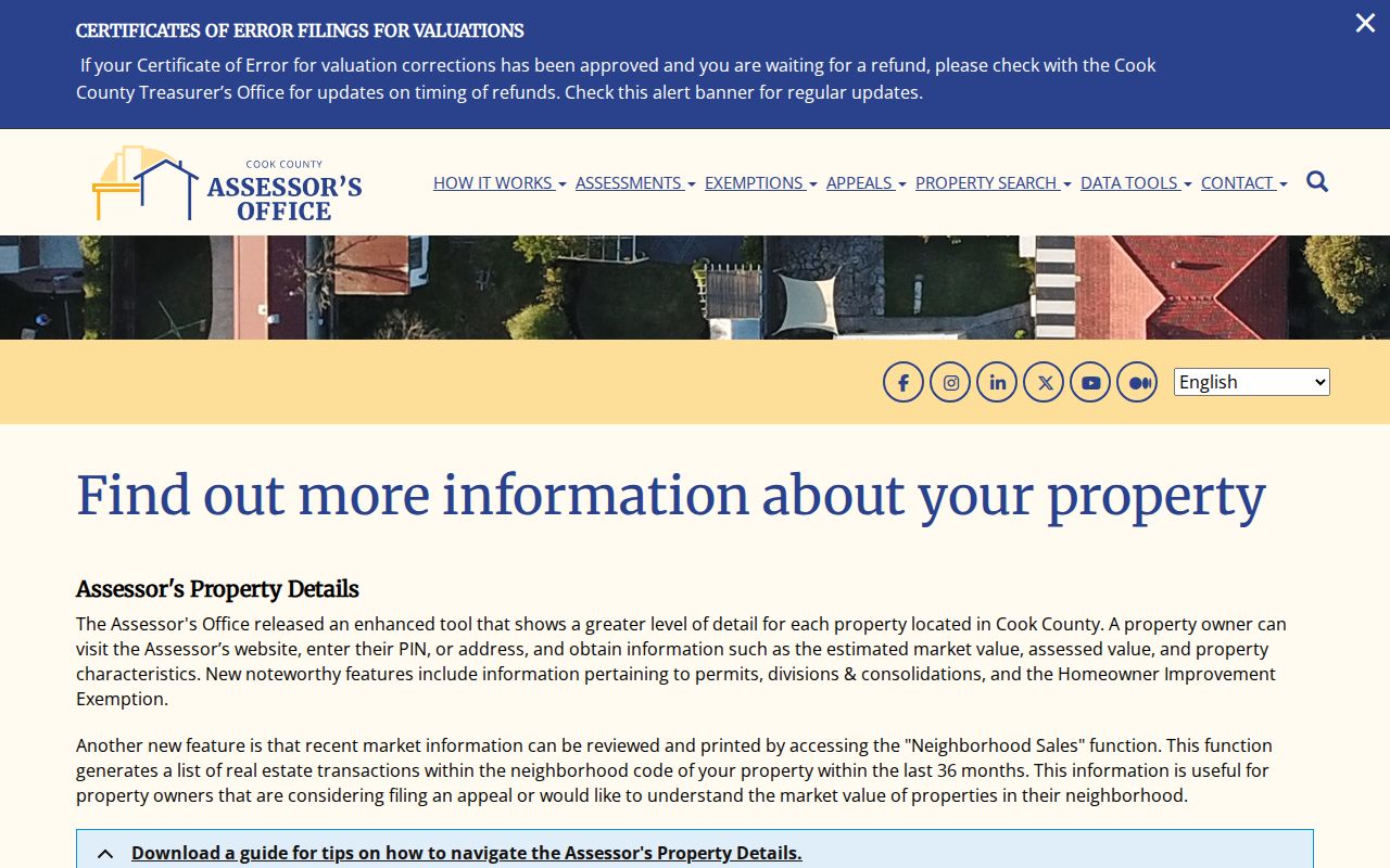
The image helps separate property facts, such as classification and assessed value, from any unsupported claim about the people inside the parcel.
Arlington Heights Street Numbering
The current Village street-numbering code gives Arlington Heights two reference lines. North-south numbers begin at the north line of Campbell Street. East-west numbers begin at the west line of Dunton Avenue. Numbers advance at 800 per mile, or 100 per eighth-mile. On north-south streets, even numbers sit west and odd numbers east. On east-west streets, even numbers sit north and odd numbers south.
This logic is useful when an old street directory gives a number that no longer produces a clean web result. Test its side and distance from the baseline, but do not announce a renumbering from math alone. The research found no official blanket renumbering year. A mismatch may instead reflect a subdivision, annexation, extension, direction change, suffix rule, or postal update.
The numbering code's baseline and parity rules are visible in the official source capture linked above.
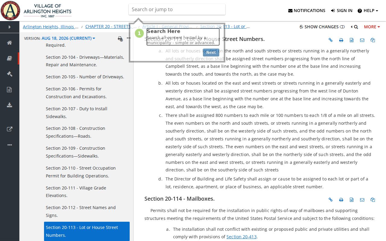
That source turns a vague historical address into a testable location while keeping uncertainty in the final notes.
Note: Preserve the old printed address beside the normalized version so a later researcher can reproduce the match.
Map Arlington Heights Parcels
CookViewer searches by address, PIN, or intersection. Its nearby search can begin at one selected parcel and expand by radius. Parcel layers, historical archives, comparison tools, and printable map reports make it useful for following both sides of an Arlington Heights street. Date every export because the observed application release was May 28, 2026.
An address result can point to a property within about 100 feet if it does not select a precise parcel. That is a meaningful limitation. Confirm the PIN and parcel shape before attaching a deed or name. Adjacent land also does not prove a shared household, association, or mailing address.
- Parcel
- A mapped unit of land identified in Cook County by a PIN.
- Situs address
- The physical property location, which may differ from an owner's mailing address.
- Plat
- A recorded map that divides land into blocks, lots, roads, or easements.
- Criss-cross directory
- A directory arranged by street and house number instead of only by surname.
Arlington Heights Permit Addresses
The Village's permits and licenses page routes current work into Civic Access. Its public shell exposes application, permit, inspection, account, upload, and scheduling functions, though the research did not verify a complete anonymous historical search. Permit records may identify a property, work type, applicant, contractor, and inspection event. Each role should keep its exact label.
The Civic Access portal is the direct route for the current workflow.
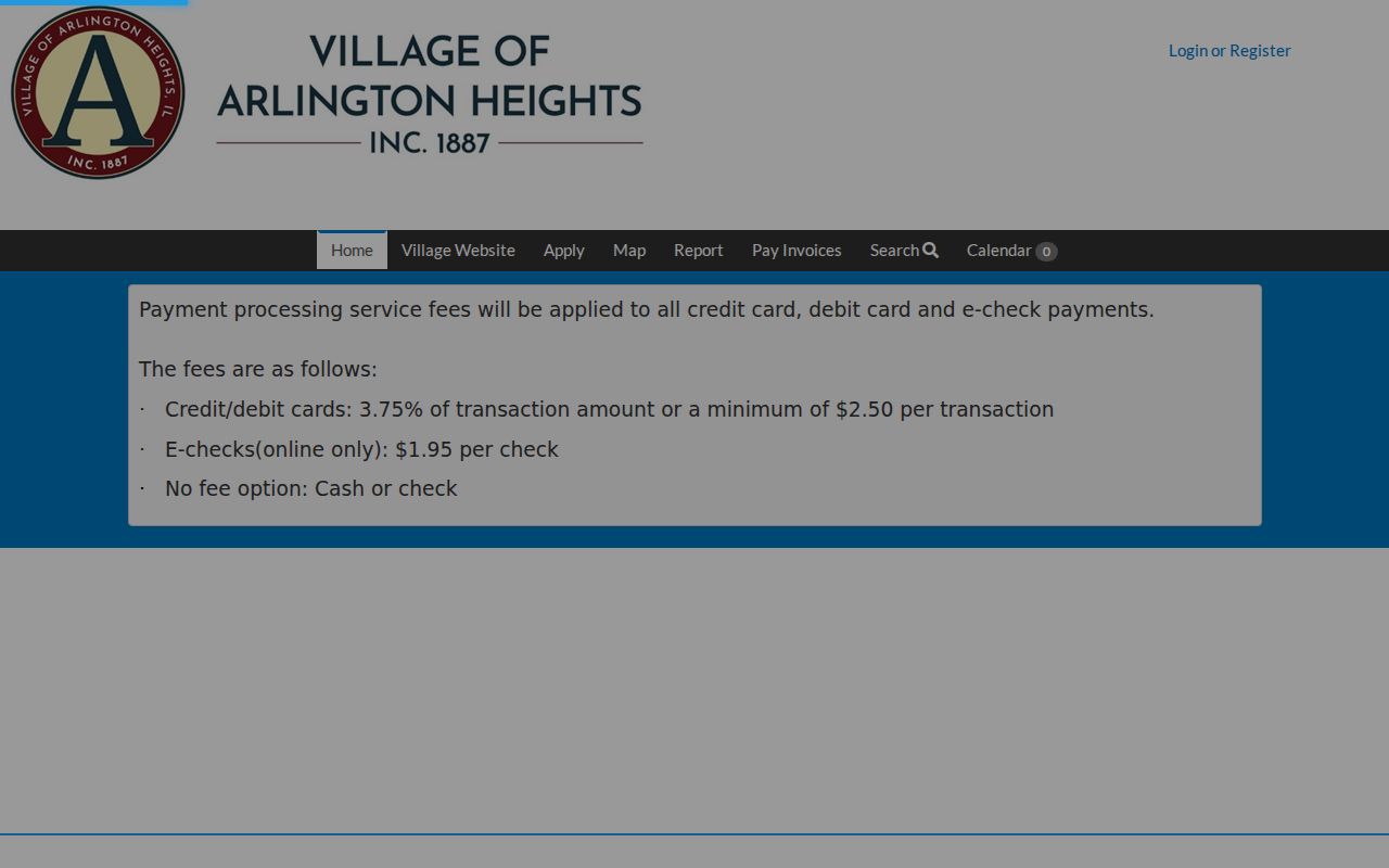
This capture shows why a portal result must be described as a permit or inspection event, not proof that a named person lived at the address.
For files not visible there, submit an address, PIN, record type, department, and date range through the Village FOIA process. Requests can go through the online portal and the other channels stated by the Village. A narrow description gives staff a better chance of locating an older permit, map, inspection, ordinance, or report.
Arlington Heights By-Address Records
Several official systems support a street-by-street search, but each answers a different question. Use the Arlington Heights street directory as an evidence ledger. Record the keeper, the source date, and the role shown before joining one result to the next.
| Record Set | Keeper | What It Shows | Access |
|---|---|---|---|
| Assessment and tax data | Cook County Assessor and tax portal | PIN, property traits, values, tax history, exemptions | Free web forms; CAPTCHA may apply |
| Parcel GIS | Cook County GIS | Parcel geometry, nearby PINs, historical layers | Free CookViewer |
| Recorded documents | Cook County Clerk Recordings | Deeds, liens, plats, easements, dates, parties | Online index; copies or office help |
| Registration confirmation | Illinois State Board of Elections | Exact-match response for facts already known | Restricted input, not street browsing |
| Permits and inspections | Village of Arlington Heights | Address-linked work and inspection events | Civic Access or FOIA fallback |
The chain is address to PIN, PIN to recorded document, then document number to an image or certified copy when needed. The Assessor card and a deed event may change on different dates. A permit applicant may be a contractor. A voter response confirms supplied facts but does not publish a block roster.
The Cook County property portal is shown in the official capture linked here: open the property address portal.
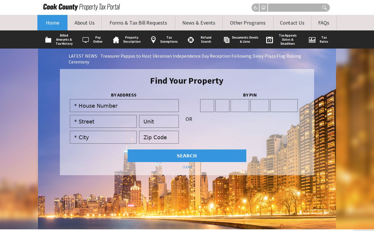
The portal's address and PIN routes supply the bridge between a street spelling and the stable parcel key used elsewhere.
Recorded Arlington Heights Street Events
The old Cook County Recorder of Deeds label still appears in citations, but the function moved to the Cook County Clerk on December 7, 2020. Current searches belong in Clerk Recordings System. Its base, address/PIN, and advanced paths search PIN, address, grantor, grantee, document number, type, dates, trust, subdivision, and legal description.
Keep document types exact. A deed, mortgage, lien, easement, plat, annexation, and release describe different events. Execution date means the date signed. Recording date means the county filing event. Neither automatically proves who occupied an Arlington Heights home that day.
A property-fraud alert can watch for a new recording tied to a name, address, or optional PIN. The free Cook County Property Fraud Unit explains enrollment and response. An alert is a prompt to inspect the filing, not proof of fraud.
Old Arlington Heights Street Listings
The Arlington Heights Memorial Library's house-history collection adds the sources that county portals cannot. It lists Haines near-north suburban criss-cross directories from 1979 forward, community phone and city directories, microfiche, subdivision volumes covering 1883 through 1960, maps, newspapers, and preservation resources. A dated 1999 inventory also reports municipal directory editions for 1930, 1935, 1939, 1943, and 1966 through 1971. Confirm the present shelf before visiting.
The digitized 1939 book starts with a street guide and location-of-streets pages before its alphabetical entries. That design makes the volume a true historical street directory, not just a surname list. Use its old spelling and page number, compare the current Village map and numbering code, then carry a well-supported modern address to the Assessor and GIS. The complete historical shelf belongs on the Arlington Heights city directory page.
Note: A directory entry can name a resident, business, subscriber, officer, or advertiser, so preserve the entry category.
Read Arlington Heights Street Maps
The official 2025 Village street map includes the municipal boundary, railroad, water, and an index with street name, direction, situation, and location. Its map date is March 31, 2025. Use both the index and map face. USPS answers whether an exact address receives a delivery label, while the Village map answers municipal geography.
Annexation can explain why an old directory, plat, or deed uses a township or other jurisdiction label. The Cook municipal-incorporation layer produced 516 Arlington-matching rows spanning incorporation, annexation, disconnection, and related actions from 1887 through 2024. That number is an index count, not a count of neighborhoods or properties. Keep the action, year, and source document with any boundary conclusion.
Village Street Permit Routes
The Village permit landing page provides a second source capture for the current Arlington Heights workflow: review permits and licenses.
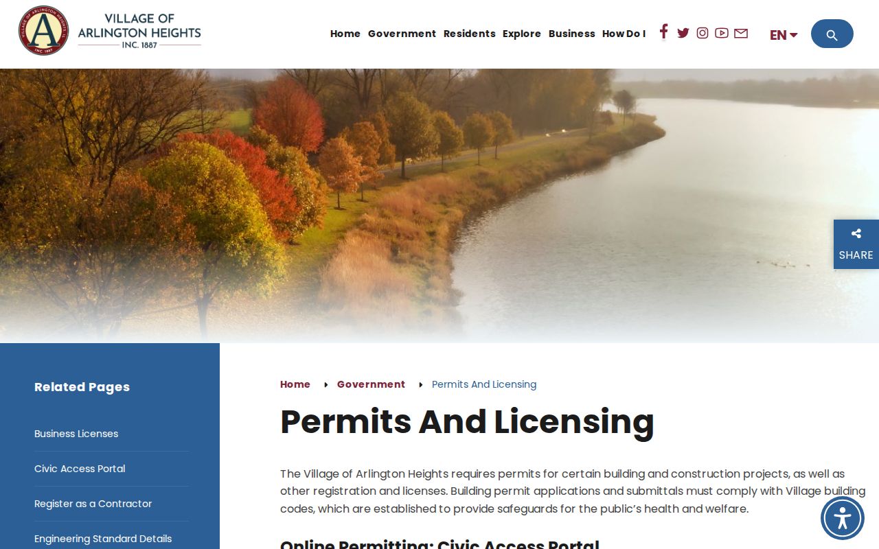
The captured page connects residents to the municipal custodian before a records request is used for material that the portal does not reveal.
Limits of Arlington Heights Street Records
A current Arlington Heights street directory cannot prove a complete household. An assessor record describes property, not every resident. A deed records an interest in land. A tax portal joins county data but does not settle physical occupancy. Voter access is restricted and exact-match, while sensitive fields are protected. Utility and driver address data are not public address lists.
Commercial directory tools may blend old sources without showing their dates or roles. Official portals are easier to audit because they name the custodian, record type, and update point. Even then, record the lookup date and verify a material fact with the office that holds the underlying record.
Lawful use. Use Arlington Heights address records only for lawful personal research. Never use a parcel, filing, or directory entry to stalk, harass, intimidate, or harm anyone.
Illinois also operates an Address Confidentiality Program for eligible survivors, which substitutes a protected mailing address in qualifying circumstances. A missing or substitute address should not be treated as proof that a record is false. For a search that shifts from a whole street to one named person, use the Arlington Heights resident lookup and keep the same two-source discipline.